Col de Joux Plane from Samoens in the Haute Savoie
Col de Joux Plane is situated in the Chablais and links the town of Morzine to the north with Samoens to the south.
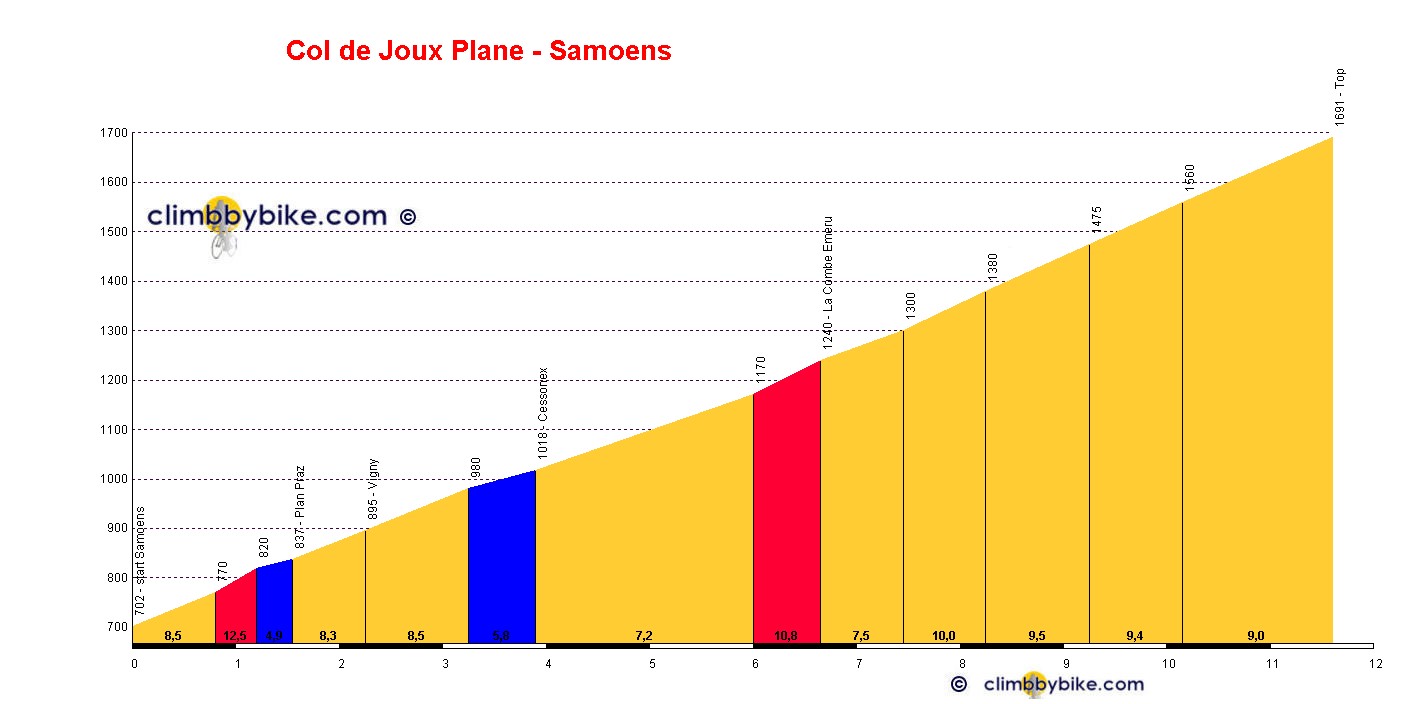
Regarded as one of the toughest climbs in the Haute Savoie, the climb is unrelenting throughout at between 7 and 10%. Most of the climb is in alpine pastures with spectacular views before entering a forest near the top. After a short descent around a lake, a short climb takes you on up to the summit.
The Tour de France crossed the col for the first time in 1978 and a further 10 times since then. The 2016 Tour de France crosses it for a twelfth time in its history.
Length: 11.6km
Height at start: 702m
Height at finish: 1691m
Average gradient: 8.5%
Maximum gradient: 12.5%